Aerial photography vs aerial videography: choose the format your audience needs
A still frame explains; a moving shot reveals
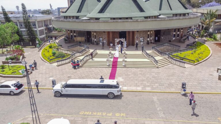
Aerial photography gives you a precise image that can hold attention in a property listing, report, website banner or print campaign. Aerial videography shows movement through or around a place: an approach, reveal, orbit, route or change in scale. The format should follow what the audience needs to understand.
Choose neither by novelty. A ground photograph may explain an entrance better than a distant aerial view, and a controlled ground video may tell a person-led story better than repeated drone movement. Aerial work earns its place when height and perspective add information or emotion that the rest of the production cannot.
Shammah Media offers drone videos and drone photography for approved projects in Kenya. Every request begins with the exact location and an operational assessment; photography and video are not confirmed merely because they appear in a creative brief.
Send us the location and final channels.
Compare the formats by final use
If the content must work in print, photography is essential. If the story depends on movement or sequence, video is stronger. If the campaign spans web, print, presentations and social, a planned combination can be efficient.
| Need | Aerial photography | Aerial videography |
| Website hero | Strong when the design needs one stable composition and readable text space | Useful when the site can deliver video efficiently and a short loop adds meaning |
| Property listing | Clear still views are easy to scan and compare | A short sequence can connect buildings, grounds and surroundings |
| Brochure or report | High-resolution stills fit print and page layouts | A linked video can support the document but cannot replace print imagery |
| Social campaign | Individual vertical or square crops can publish independently | Movement can stop attention, but versions need platform-aware editing |
| Presentation | A still is reliable, silent and easy to place | A reveal can open a film or section when playback and sound are controlled |
| Construction update | Repeat still viewpoints make dates easier to compare | Movement can explain scale, route and current activity |
| Hospitality or tourism | Stills show destination context and key views | Video can create a sense of arrival and journey |
Choose aerial photography for flexible visual assets
Still photographs are useful when designers need a defined crop, high-resolution detail and a file that remains visible for as long as the reader chooses. They can support:
Tell us the intended orientation and placement. A wide banner needs clean space for text; a vertical cover needs a different composition. Cropping one photograph into every shape can remove the very subject the aerial view was meant to show.
Ask for a coherent selection rather than a large number of similar heights. One establishing frame, useful angled contexts and a limited top-down view may provide more campaign value than dozens of near-duplicates.
- Property, hospitality and development pages
- Annual reports and stakeholder updates
- Brochures, presentations and display graphics
- Architecture and destination portfolios
- Social posts and campaign covers
- Repeat visual progress records
Choose aerial videography for movement and spatial sequence
Aerial videography is most useful when the route through a space matters. A reveal can introduce a lodge behind landscape, an approach can establish arrival, and a controlled lateral movement can relate a building to its grounds.
Plan each movement with an edit in mind:
Long, unchanging flights rarely make a stronger film. A few stable, purposeful shots give the editor more control. Review complete video production when the aerial material must become part of interviews, property walk-throughs or a wider brand story.
- What does the viewer see first?
- What new information is revealed?
- Where can the editor enter and leave the shot?
- Does the movement connect with the next ground scene?
- Will the frame work in horizontal, vertical or both?
Combine both formats without dividing attention
1. Name the master deliverables
List the exact still layouts and video versions. “Photos and clips” is too vague to guide capture or quotation.
2. Rank the must-have views
Photography and video may need different position, light and time. Protect the highest-value view first rather than attempting every variation.
3. Build one operating plan
The exact location, subject boundary, people, roads, site activity, privacy and authorization affect both formats. Coordinate them within one confirmed arrangement.
4. Allow deliberate mode changes
Making a refined still composition and a smooth moving shot are different tasks. The schedule should allow the operator to set each up without rushing.
5. Connect aerial and ground content
Choose an exterior feature, entrance or activity that can bridge the aerial view to a ground photograph or scene. The result feels like one production instead of an isolated drone montage.
Design deliverables for the real channels
For aerial photographs, define edited image count or priority views, resolution, colour treatment, crop variants, file format, delivery and usage.
For aerial video, define whether you receive selected edited clips, a finished standalone film, or aerial material incorporated into a larger edit. State duration, orientation, resolution, titles, music, review rounds and every cut-down version. Raw footage is not an automatic inclusion and may not be useful without colour, selection and context.
Social platforms change, so specify the channels and layout rather than relying only on an aspect-ratio label. Keep titles and essential action away from areas covered by platform controls.
Apply one compliance standard to both
Kenya’s UAS framework does not become optional because the output is a still rather than a video. KCAA’s published regulations address authorization, commercial operation, operating areas, people, roads, aerodromes, privacy and recorded images. Current requirements and the particular operation must be reviewed by the competent operator.
Provide coordinates, boundaries, dates, site contacts and known constraints before booking. Do not use an old flight at the site as proof that a new operation is approved. Weather, airspace information, people and site activity can change.
If the flight cannot proceed, consider ground photography, a fixed elevated position, existing appropriately licensed material or a redesigned shot. No campaign outcome is improved by an unsafe or unauthorised operation.
Protect privacy in both capture and edit
An aerial frame can include neighbouring homes, workers, guests, number plates, security arrangements or activity beyond the subject. Define what may be captured and published. Tell affected people about the operation and manage permissions appropriate to the project.
During editing, exclude unnecessary material and restrict file access. A wider raw clip may contain information that never appears in the final film. Client delivery and Shammah Media portfolio use are separate permissions.
What affects the quotation?
Pricing reflects the location, operational assessment, authorization work, travel, site control, required stills and movements, crew, editing, format versions and integration with ground production. Adding photographs to a video operation is not always a single button press; both require planned capture and finishing.
Share the channels and must-have outcomes. We can recommend stills, motion or a combined scope and identify a ground alternative where aerial work remains conditional.
Brief the editor before capture, not after it
When aerial video joins a larger film, share the script, sequence or edit outline before the operation. The opening direction, movement speed and end frame should connect with the ground scene that follows. A beautiful orbit may be unusable if the film needs an approach towards a specific entrance.
For photographs, give the designer actual text and layout zones where possible. A composition with clean sky on the wrong side cannot always be reversed without misrepresenting the place. Name the important subject that must survive every intended crop.
After delivery, keep original aspect-ratio masters and create platform copies from them. Repeatedly downloading and re-exporting a social version reduces quality and removes flexibility for later campaigns.
Use aerial content as evidence responsibly
An aerial image can clarify scale, but it can also exaggerate distance or imply ownership beyond a boundary. Captions, maps and sales copy should be checked by the responsible property or project team. Do not use height and angle to obscure material context that a customer needs to make an informed decision.
Date progress material and avoid carrying an old aerial view into a current campaign without review. Construction, landscaping, access and surrounding development may have changed even when the building remains recognisable.
When an agency or external editor receives aerial files, pass on the approved subject boundary, usage and privacy restrictions. A new crop, freeze frame or promotional sequence can reveal material excluded from the original public edit. Reuse should remain inside the permissions and context agreed for the project.
Frequently asked questions
Which is better for property marketing?
Photography is essential for scannable listings and print. Video can add a sense of approach, scale and connection. Many campaigns benefit from both when each has a defined use.
Can one flight capture photos and video?
It may be possible within one approved operation, but the views, light, timing and deliverables must be planned. Neither format should be assumed from the other.
Do drone videos include editing?
Only the editing stated in the quotation. Selected clips, a finished aerial film and integration into a larger production are different outputs.
Can you deliver vertical aerial video?
It can be planned when the platform and final composition are known. A crop from horizontal footage may not preserve the subject effectively.
Is permission different for photography and video?
Both are UAS imaging operations and require operation-specific assessment under current applicable requirements. Privacy and publication permissions also matter in either format.
What if aerial work is not feasible?
We can discuss ground photography, fixed elevated views or a revised production plan. An alternative should support the audience’s need rather than imitate a drone shot poorly.
Choose your aerial format
Send Shammah Media the coordinates, audience, desired views, website, print, presentation or social uses, and whether movement is essential. We will assess the operation and recommend aerial photography, aerial videography or a useful combination.
Request an aerial content assessment.