
Drone Photography That Shows the Bigger Picture
Show what cannot be seen from the ground
Some stories need a wider view. Drone photography can reveal the scale of a development, the setting of a hotel, the layout of a venue or the relationship between a property and its surroundings in a single compelling image.
Shammah Media plans aerial photography for property, construction, hospitality, tourism, events and approved commercial assignments in Nairobi and across Kenya. We begin with the exact location and purpose, define the views you need and assess whether the requested operation can be completed responsibly.
Drone availability is never assumed. The location, airspace, site activity, permissions, operating arrangement and weather all affect whether a flight can be confirmed. You receive a clear answer and written scope before booking.
Send us the location and aerial views you have in mind.

Where aerial photography adds value
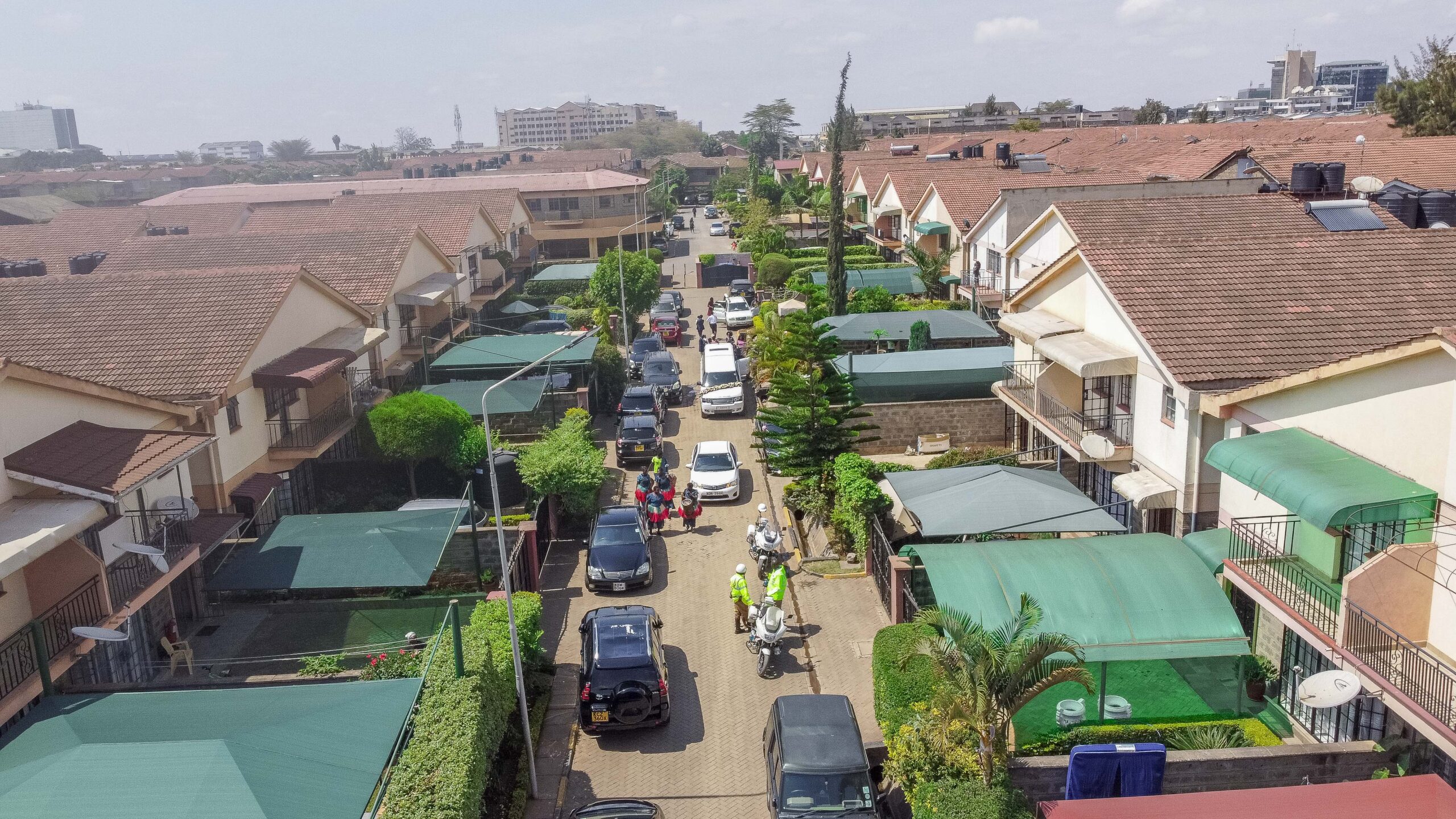
Property and real estate marketing
Place a home, apartment development, commercial property or hospitality venue in context. Aerial images can show grounds, access, outdoor amenities, neighbouring landscape and the overall scale of a site. Combine them with real estate photography for interiors and ground-level details.
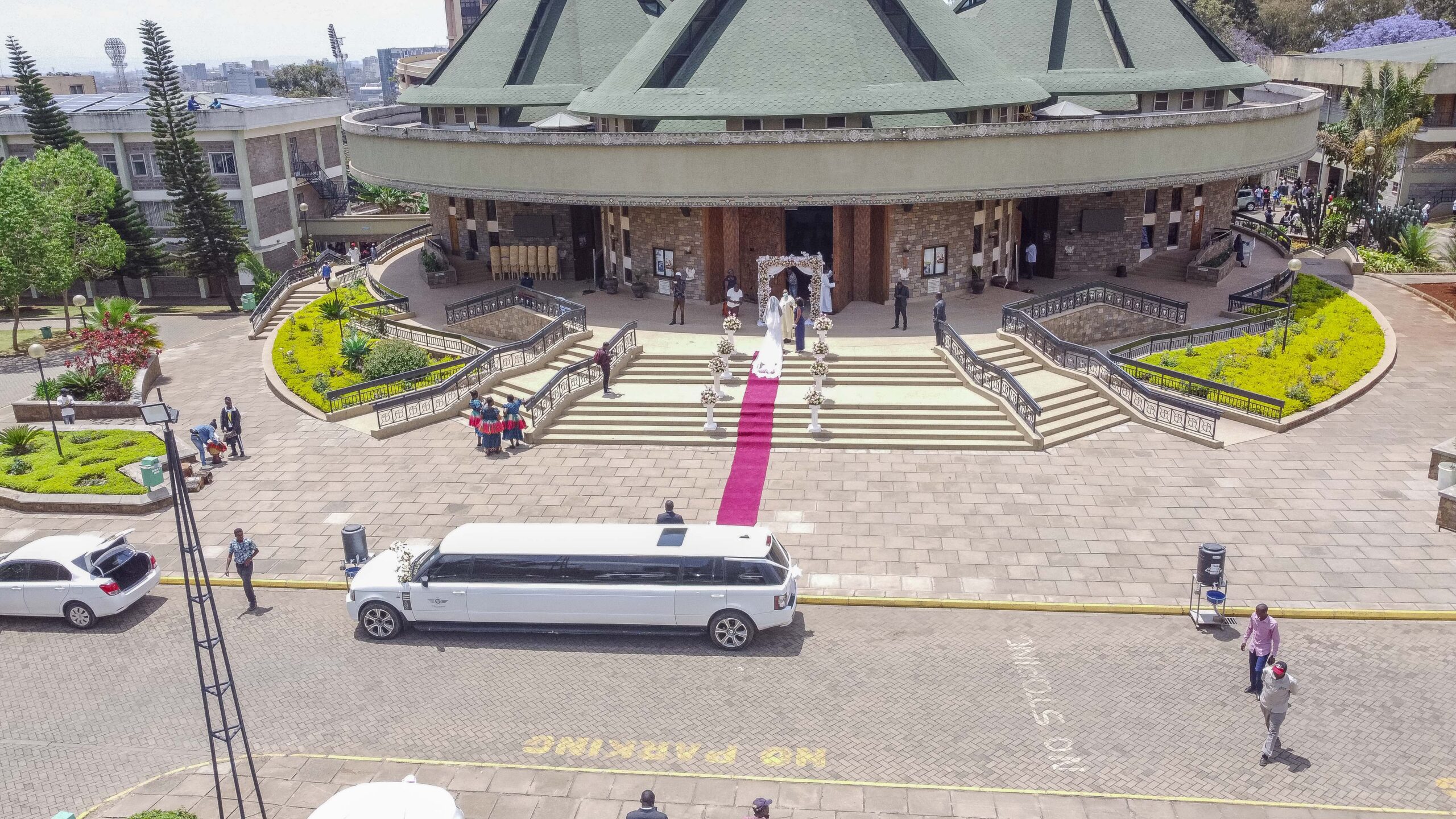
Construction and development updates
Create clear visual records for stakeholders, reports and marketing campaigns. Repeat visits can use agreed viewpoints and file naming to make progress easier to follow. These images are photographic records; they are not survey-grade measurements or certified engineering data.
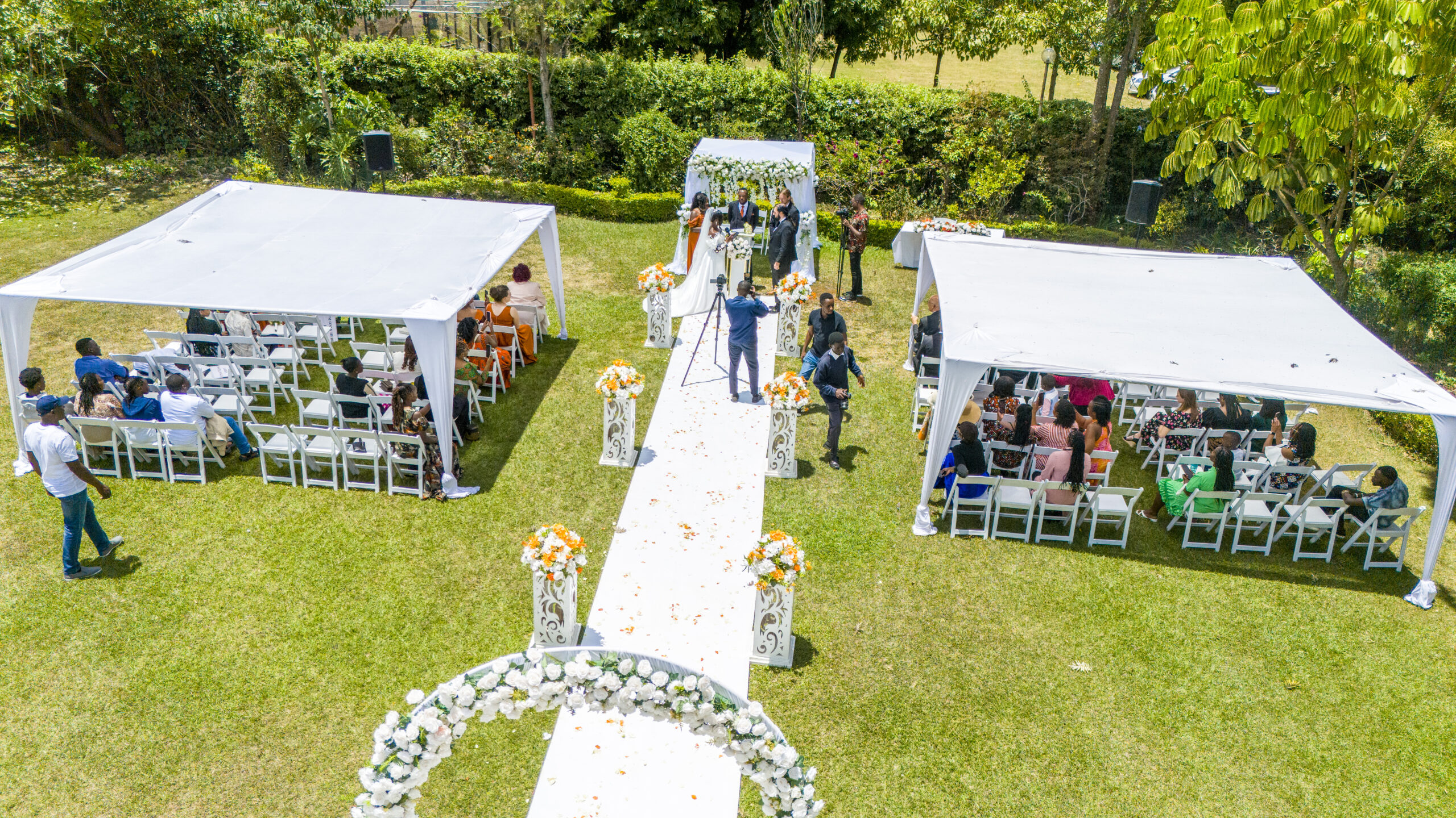
Hotels, lodges and destinations
Help potential guests understand the setting before they arrive. Aerial photographs can connect accommodation, facilities, landscape and surrounding attractions where the location and operation are approved. They work particularly well alongside interior photography and a destination video.

Corporate, industrial and agricultural sites
Show the footprint and organisation of a facility, campus, farm or operational site. We account for security, confidential areas, staff activity, vehicles, obstacles and business continuity when reviewing the brief.

Events and outdoor venues
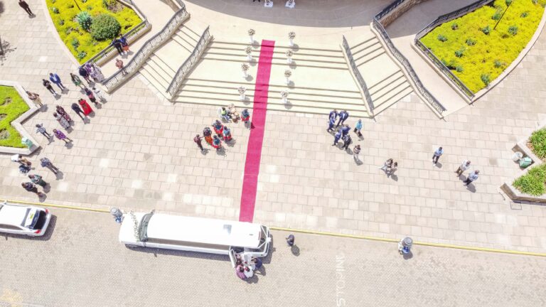
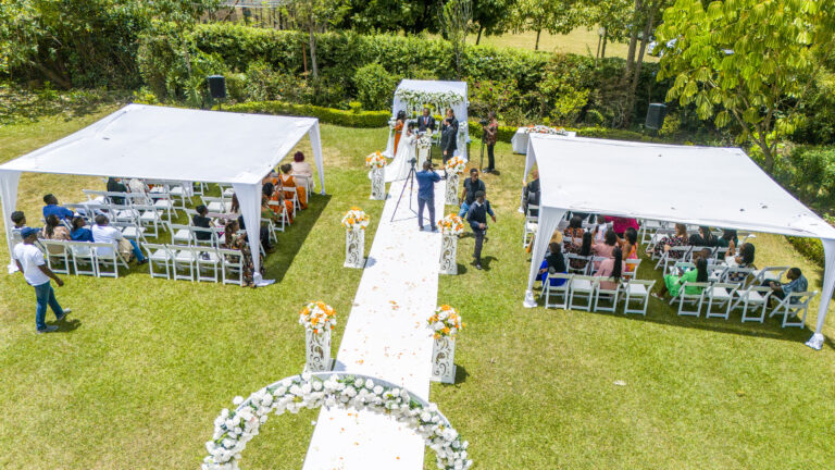
An approved aerial view can establish the atmosphere and scale of a festival, conference venue, wedding setting or organised outdoor event. The flight must be considered during event planning because crowds, programme timing, access and ground control affect feasibility.

Architecture and completed projects
Present the relationship between a building, landscape and wider site. Architects, contractors, designers and developers can use aerial views with a ground-based portfolio to show form and context more completely.
Still photographs or drone video?
Choose drone photography when you need high-resolution still images for listings, websites, reports, brochures, presentations, social media or large visual displays. Still compositions can be planned for horizontal banners, vertical posts or specific page layouts.
Choose drone video when movement is central to the story. A reveal, approach, orbit or sequence can help viewers experience a location in a way that one photograph cannot. Photography and video may be planned within the same approved operation, but they remain separate deliverables and should be requested together at the quotation stage.
If you are unsure, explain what the audience should understand or feel. We can recommend the most useful mix of aerial stills, video and ground coverage for that outcome.
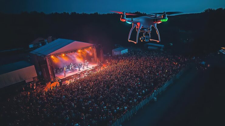

What your aerial photography package can include
The final scope depends on the site and marketing purpose. It may include:
We plan the required views before the proposed flight. This keeps the operation focused and gives the final image set a clear purpose instead of producing many similar photographs with no defined use.
- Wide establishing views of the property, venue or development
- Angled aerial views that show buildings and grounds together
- Top-down compositions where they are useful and feasible
- Exterior context, access routes and landscape relationships
- Repeat viewpoints for visual progress records
- Horizontal and vertical framing for agreed marketing channels
- A selected and edited set of aerial photographs
- File versions prepared for web, presentation or print use
- Coordinated ground photography or video as separately listed deliverables
Choose drone video when movement is central to the story. A reveal, approach, orbit or sequence can help viewers experience a location in a way that one photograph cannot. Photography and video may be planned within the same approved operation, but they remain separate deliverables and should be requested together at the quotation stage.
If you are unsure, explain what the audience should understand or feel. We can recommend the most useful mix of aerial stills, video and ground coverage for that outcome.
What we need to assess your location
Please include as much of the following as possible with your enquiry:
An accurate brief lets us identify feasibility questions early. It also gives you a more useful quotation than a generic request for “a few drone shots.”
- Exact site coordinates or a shareable map pin
- Project purpose and intended publication channels
- Property owner, venue manager or site authority
- Preferred date and an alternative date window
- A short list of the aerial views you need
- Known nearby airports, airstrips or sensitive facilities
- Expected people, vehicles and normal site activity
- Buildings, trees, masts, power lines or other known obstacles
- Access, parking and security arrangements
- Areas that must not be photographed or published
- Ground photography or video requirements
- Image orientation, format and delivery deadline
- Name and contact details of the on-site decision-maker
Aerial photography in Kenya requires a location-specific check
Drone work is an aviation activity, not simply an elevated camera angle. The Kenya Civil Aviation Authority’s official resources currently include the Civil Aviation (Unmanned Aircraft Systems) Regulations, 2020, implementation standards, regulatory fees and Remote Air Operator Certificate information. You can view the current KCAA unmanned aircraft systems resources here.
Different locations and operations can involve different requirements. We therefore do not promise that a flight is available everywhere, that a property owner’s approval is the only permission required or that a short flight avoids normal planning responsibilities.
We also do not publish unverified claims about a particular pilot licence, operator certificate, aircraft registration or approval. The appropriate operating arrangement and requirements are checked for the specific assignment before aerial coverage is confirmed.
Combine aerial and ground-level storytelling
Aerial photographs are strongest when they perform a specific role in the wider image set. They show setting and scale; ground photographs show interiors, people, materials and eye-level experience.
For property campaigns, combine aerial context with professional photography services. For developments, hospitality launches and corporate stories, video production can bring the ground and aerial views into one edited narrative. For conferences, weddings and organised events, add event photography for the people and moments that an aerial view cannot capture.
If the final images will appear in brochures, a sales office or an exhibition, mention the print dimensions before production. The composition and delivered file may need to support that larger physical use.
Weather, light and changing conditions
Wind, rain, visibility and local conditions can change the flight decision. Even when the date is important, safety and applicable requirements take priority. Your quotation can explain the decision point, rescheduling treatment and whether other ground-based work will continue if the aerial portion cannot proceed.
Light affects the creative result as well. The orientation of a building, haze, shadows and the priority view may influence the preferred time. Share any façade, landscape or feature that must look its best so this can be considered during planning.
No responsible supplier can guarantee a specific sky or flight before the conditions and verified operating limits are known. A flexible date window is helpful for projects where aerial images are central to the campaign.
Privacy, security and neighbouring property
Aerial cameras may see beyond the main subject. Neighbouring homes, people, vehicles, security arrangements or confidential activities can enter the frame. Tell us which areas must be avoided and what may not be published.
The client is responsible for providing truthful site information and confirming the authority, notices or participant permissions within its control. The capture plan should minimise unnecessary personal and security-sensitive detail rather than relying on editing after the flight.
This deserves particular care at private homes, schools, places of worship, active workplaces and events. If people are intentionally part of the campaign, their role and image use should be agreed before production.
Drone photography is not surveying or certified mapping
People sometimes use “aerial mapping photography” to describe any top-down drone image. Ordinary aerial photographs, however, are not automatically accurate maps, measurements, 3D models, boundary records or engineering inspections.
Technical mapping can require specialist sensors, ground control, software, methods and qualified professional interpretation. Shammah Media does not present marketing photographs as surveying, cadastral work, certified inspection data or guaranteed measurements.
If you require areas, distances, volumes, coordinates or evidence for a technical decision, state that clearly at the beginning. The assignment may need an appropriately qualified specialist rather than a commercial photography service.
Light, weather and the right time to photograph
The appearance of a building changes throughout the day. Exterior light, room orientation, views, installed lighting and business activity can all influence the schedule. Share the priority façade or view when you know it, and tell us if a room can only be accessed at a particular time.
Weather can also affect exteriors and aerial coverage. We will not promise a particular sky or condition, but the quotation can define how a weather-dependent postponement, changed schedule or split visit will be handled. This is especially useful for developments or hospitality properties where outdoor spaces are central to the campaign.
Coordinated photography, video and print
Some properties need more than a still-image gallery. Add drone photography where the assignment permits it. Aerial views can help explain the site, surroundings or scale of a development, but they require separate assessment and are not automatically included in ordinary property photography.
For a walkthrough, development story or hospitality campaign, combine the shoot with property-focused video production. Drone video can add movement and wider location context. If you are preparing a sales office, investor pack or property exhibition, our printing services can carry the same visual campaign into physical materials.
Coordinating these services can make the campaign more consistent. Each deliverable will still be listed separately so you know exactly what is included.
What determines your quotation?
Drone photography pricing starts with the actual operation, not only the number of final images. Your quotation may consider:
The written quotation confirms what is included before you book. Our current planning terms use a 14-day quotation validity period, a 50% booking deposit and one consolidated review round. Digital working files are normally retained for 90 days, and travel outside Nairobi is quoted separately. Your signed quotation takes priority wherever different terms are agreed.
- Exact site and travel requirements
- Intended use and required aerial views
- Site access, security and ground coordination
- Current operational and authorisation requirements
- People, obstacles and normal site activity
- Preferred date, time window and weather contingency
- Number of visits or repeat-progress schedule
- Still-image selection, editing and file versions
- Ground photography, drone video or other additions
- Delivery deadline and publication requirements
FAQs
No. Every request depends on the exact site, airspace, operation, permissions, safety, security and current requirements. We assess the location before confirming availability.
Property or site authority is necessary, but it may not settle aviation, airspace, safety or other applicable requirements. The complete operation must be assessed.
No flight can be guaranteed regardless of conditions. Weather, site activity, security or regulatory factors may require a changed time, postponement or decline. The quotation can state how that situation will be handled.
They may be planned within the same approved operation. Tell us that you need both when requesting a quote because the still compositions and video movements are separate deliverables.
Assignments across Kenya can be assessed using the exact map pin, purpose, date window, access and travel requirements. Availability remains location-specific.
Not as an ordinary photography service. If you need survey-grade mapping, measurements or certified technical data, the project requires a specialist scope and suitably qualified provider.
Our standard photography delivery window is two to four weeks after capture, depending on the assignment. Any different deadline must be agreed before booking.
How the booking process works
Provide a map pin, not only the town or estate name. Tell us what the images should show, where they will be published, your preferred date and the final delivery deadline. Reference images, a site plan or a marked screenshot can help explain the angles you have in mind.
Before promising availability, the proposed operation is reviewed against the site, airspace, current requirements, people, obstacles, security, weather considerations and appropriate operating arrangement. Property-owner approval is important, but it does not by itself settle every aviation or operational requirement.
You nominate an authorised site contact and confirm access, property authority, working hours, confidential areas and known hazards. We agree on the take-off and landing area, site movement and what will happen if conditions do not support the planned flight.
If the assignment is feasible, the quotation records the aerial views, related ground work, output formats, schedule, travel and weather or rescheduling terms. If it is not feasible as requested, we may recommend another date, a changed scope or ground-based coverage.
The flight proceeds only when the operation can be supported for the confirmed date and conditions. The selected photographs are then edited and supplied in the versions listed in your quotation. Shammah Media’s standard photography delivery window is two to four weeks, depending on scope and schedule.
Start with the location
Tell us what you are planning and what the photographs need to achieve. Send the service, date, location, timing and preferred final products, and we will respond with the next steps for your project.