Plan aerial photography in Kenya before you promise the shot
A drone image begins with coordinates, purpose and permission
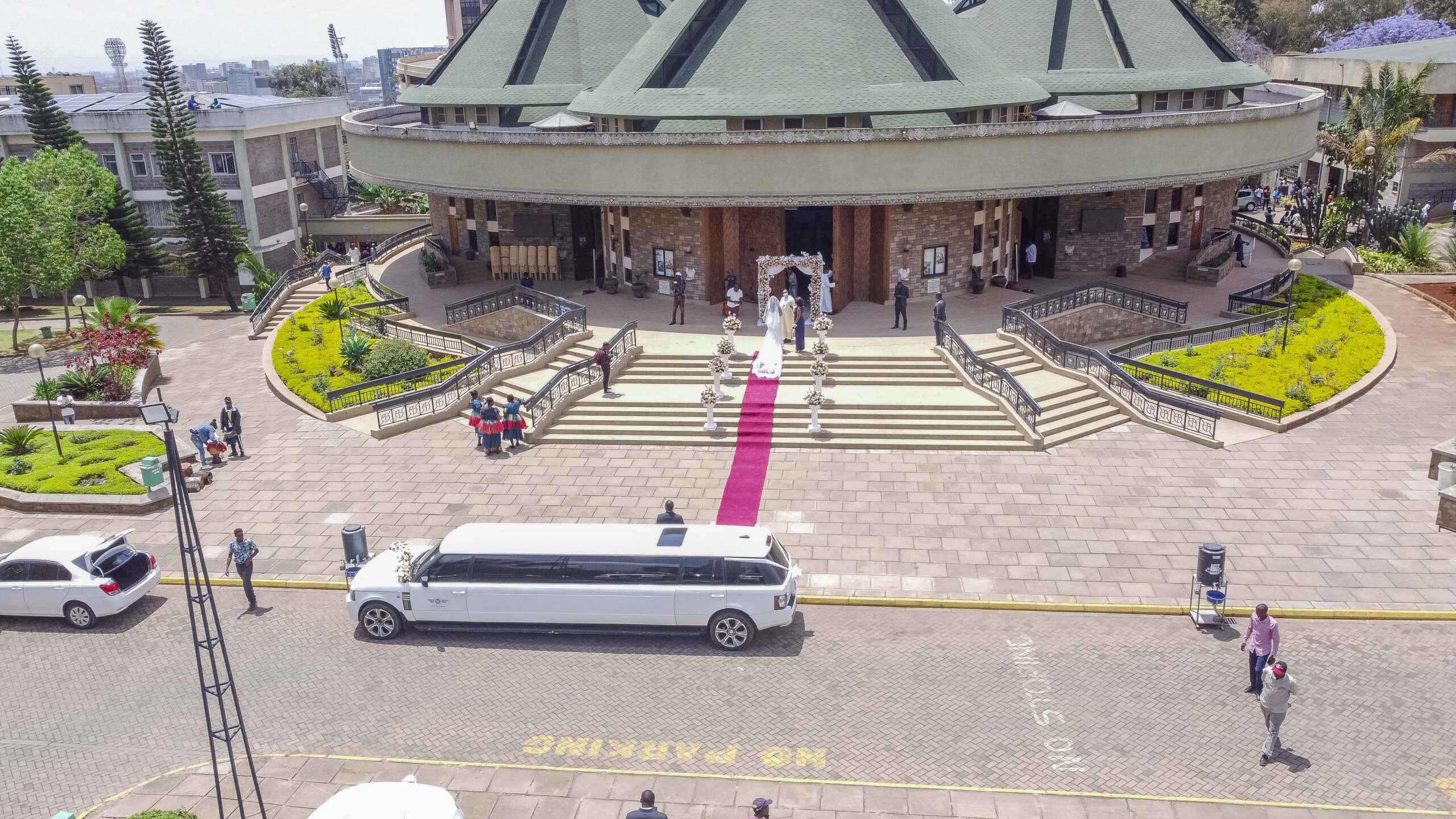
Aerial photography can reveal a property’s scale, a development’s relationship to its surroundings or a venue’s setting in one frame. It can also be impossible or inappropriate at a particular place, time or operating arrangement. Treat the flight as an assessed operation, not a guaranteed camera angle.
Kenya Civil Aviation Authority regulations state that UAS operations require Authority authorization and that commercial operations for reward or hire require a Remote Aircraft Operators Certificate. Current restrictions also address operating categories, airspace, people, roads, aerodromes, privacy and other conditions. Requirements can change or apply differently to a specific operation, so the project must be checked against current KCAA information rather than relying on a generic blog summary.
Shammah Media offers drone photography in Kenya for approved assignments through a confirmed operating arrangement. We do not promise a flight before the exact location, brief and applicable requirements have been assessed.
Send the coordinates and views you need.
Start with the marketing or documentation outcome
“Get drone shots” is not a usable brief. Explain what the audience must understand and where the finished photographs will appear.
Common outcomes include:
For each outcome, identify the subject, direction and useful context. A top-down image may show layout but hide façades. A lower angled view may communicate buildings and landscape more clearly. A dramatic height is not automatically the most informative choice.
- Showing a property, hotel or venue in its wider setting
- Establishing the footprint of a development or campus
- Connecting buildings, grounds, access and amenities
- Creating approved progress photographs from repeat viewpoints
- Presenting landscape context for architecture or tourism
- Producing a wide website banner or vertical campaign image
- Establishing the scale of an organised outdoor event where feasible
Give the assessment enough location detail
Provide:
Do not hide a sensitive feature because it may complicate approval. An accurate assessment early is better than discovering a restriction after crew, client and venue have assembled.
- Exact coordinates or a map pin
- Site address and property boundary
- Proposed date range and useful time of day
- Site owner or authorised contact
- Nearby aerodromes, helipads or aircraft activity you know about
- Roads, crowds, schools, hospitals, security sites, masts or power lines nearby
- Access route, parking and take-off/landing space
- Active construction, cranes, vehicles or livestock
- Images or a plan showing the desired views
- People or neighbouring property likely to appear, plus the final use and publication area
Understand the client’s role in authorization and access
The operator is responsible for aviation compliance within the confirmed arrangement, but the client still controls essential project information and site access. You should identify the owner, obtain venue or property permission where required, disclose site activity and avoid scheduling people into a proposed operating area without coordination.
KCAA’s published regulations include restrictions concerning persons, buildings, structures, vehicles, roads, aerodromes, designated areas and privacy. They also provide for Authority approvals in defined circumstances. Do not interpret a distance or general rule as personal permission to proceed; the competent operator must assess the complete operation and current approvals.
Ask the provider to explain which party is responsible for each permit, site letter, access approval, coordination or fee. Do not publish an aerial production date until it is confirmed.
Protect privacy and control the frame
An aerial camera can see beyond the client’s immediate subject. KCAA’s UAS regulations address imaging people and private property, consent, privacy and captured material outside an approved area. Kenya’s other privacy and data-protection requirements may also apply.
Before the proposed flight:
The final composition should serve the brief without collecting unnecessary information. If the required view cannot respect privacy or authorization, choose a ground photograph, a different angle or another time.
- Define the property or subject that may be captured
- Identify homes, guests, workers or neighbouring sites in view
- Tell relevant people about the operation and manage permission
- Remove confidential material or activity where practical
- Decide whether faces, number plates or security features require exclusion
- Restrict access to files according to the project
Design a short, useful aerial shot list
1. Establish the whole subject
Choose one view that lets the audience recognise the property, development or venue and its immediate context.
2. Show relationships
Plan angles that connect buildings to grounds, amenities, landscape or access. State which relationship matters; surrounding context should not be left to chance.
3. Allow for final layouts
Name the horizontal website banner, portrait page, square post, report cover or print panel before capture. Composition and clear space can then support the design.
4. Limit duplicate viewpoints
Ask for purposeful variations, not a large set of almost-identical heights. A concise shot list gives more attention to the views that will actually be published.
5. Coordinate ground coverage
Use real estate photography for interiors, rooms and human-scale details. Aerial photographs add context; they do not replace a complete property story.
Plan repeat progress photography carefully
Repeat aerial photographs can make change easier to understand when the operation, view and file organisation are consistent. They are still photographic records, not survey-grade mapping, engineering certification or measured inspection unless a separately qualified technical service is explicitly contracted.
Record the intended direction, framing reference, subject boundary, date and file naming. Exact replication can be affected by authorization, construction activity, cranes, weather, vegetation and changing site access. Agree on an acceptable visual match rather than promising identical flight conditions.
Schedule progress visits around a decision or reporting need. Frequent flights without a clear use create more files, not necessarily better evidence.
Treat weather and site activity as real constraints
Wind, rain, visibility and light affect whether an operation can proceed and whether the photographs will be useful. The remote pilot or responsible operator decides whether conditions remain acceptable; a marketing deadline does not override that decision.
Create a weather decision window and identify who receives the update. If ground photography can continue, separate it in the schedule. Where the final campaign depends on one particular seasonal or landscape condition, allow more than one potential date.
Site activity can change quickly. Vehicles, crowds, temporary structures and unauthorised people may make the planned area unsuitable. Assign an on-site contact who can control access and communicate operational changes.
Know what should appear in the quotation
Ask for:
Do not accept “drone included” as the complete specification. It says nothing about feasibility, legal responsibility or the files you receive.
- Exact location and project purpose
- Proposed operation window, subject to assessment and authorization
- Aerial still-photography deliverables
- Approximate edited selection or required views
- Web, print or layout-specific file versions
- Ground photography or video as separate items
- Operator, authorization, site-access and client responsibilities
- Travel, permit, coordination or location costs where applicable
- Weather and site-change process
- Editing and delivery timing
- Usage, privacy and portfolio permissions
- Limits on mapping, measurement, surveillance or technical inspection claims
What affects the quotation?
Pricing reflects the location, assessment, operating arrangement, authorization work, travel, site control, required views, photography plus video, editing, file versions and repeat visits. A simple approved property context photograph and a multi-date development record have different requirements.
Give Shammah Media the coordinates and priority outcome before requesting a figure. We can then explain whether an aerial approach is assessable and which ground alternatives would protect the campaign if it cannot proceed.
Review aerial images before publication
An impressive wide view can disclose more than the marketing team notices at first. Review the final selection at full size for people, neighbouring property, vehicle plates, security arrangements, temporary activity, misleading boundaries and information outside the intended subject.
Confirm that captions describe what the photograph actually shows. Do not label a marketing image as a survey, inspection result or current construction status unless the separately qualified work and date support that statement. Where an image will appear in a brochure or investor report, record its capture date so later readers do not mistake it for current site conditions.
Keep approved final files separate from wider working material and limit access according to the project. A public crop may need less surrounding detail than an internal progress record.
Where several departments will use the photographs, nominate one owner to approve the final public selection. Property, security, communications and project teams may notice different risks or inaccuracies. Consolidated approval avoids one department publishing a frame that another had restricted and gives future users a clear source for the approved asset.
Record the approval date beside the selected files so later users know which review it reflects.
Frequently asked questions
Can a drone fly anywhere in Kenya?
No. UAS operations are regulated, and the exact site, airspace, operating category, authorization, people, roads, privacy, weather and other conditions affect feasibility.
Does Shammah Media guarantee regulatory approval?
No. We assess the brief and confirm the operating arrangement, but an approval or flight cannot be guaranteed before the applicable process and conditions are resolved.
What information should I send first?
Send exact coordinates, property boundary, date range, site contact, desired views, nearby activity and final use. A place name alone is not enough for assessment.
Can you fly over an event crowd?
Do not assume so. Crowd, people and site conditions require operation-specific assessment and applicable authorization. A ground or elevated fixed-camera alternative may be more appropriate.
Are aerial photographs suitable for mapping or measurement?
Marketing photographs are not automatically survey-grade maps, measurements or certified technical data. Request a separately qualified technical scope if that is the actual need.
What happens when weather changes?
The responsible operator decides whether conditions permit the operation. We follow the agreed postponement, alternative-view or ground-coverage plan.
Request an aerial photography assessment
Send Shammah Media the coordinates, date range, subject boundary, site contact, priority views, intended use and any known nearby constraints. We will assess the creative and operational brief before issuing a confirmed scope.
Start your aerial photography assessment.